About the Watershed
The lakes, ponds and streams within the 30 Mile River Watershed are all connected.
What’s in a name?
The Thirty Mile River is a waterway used long ago by Native Americans and pioneers traveling from the Androscoggin River to the Sandy River Valley. The name dates back to around the 1750s, when timber hunters paddled from Lewiston up the Androscoggin River to the north end of Echo Lake in what is now the town of Mt. Vernon. Estimating they had traveled 30 miles, they named the chain of lakes, ponds and streams the Thirty Mile River.
square miles
acres


Everyone lives in a watershed…
no matter how much water is nearby.
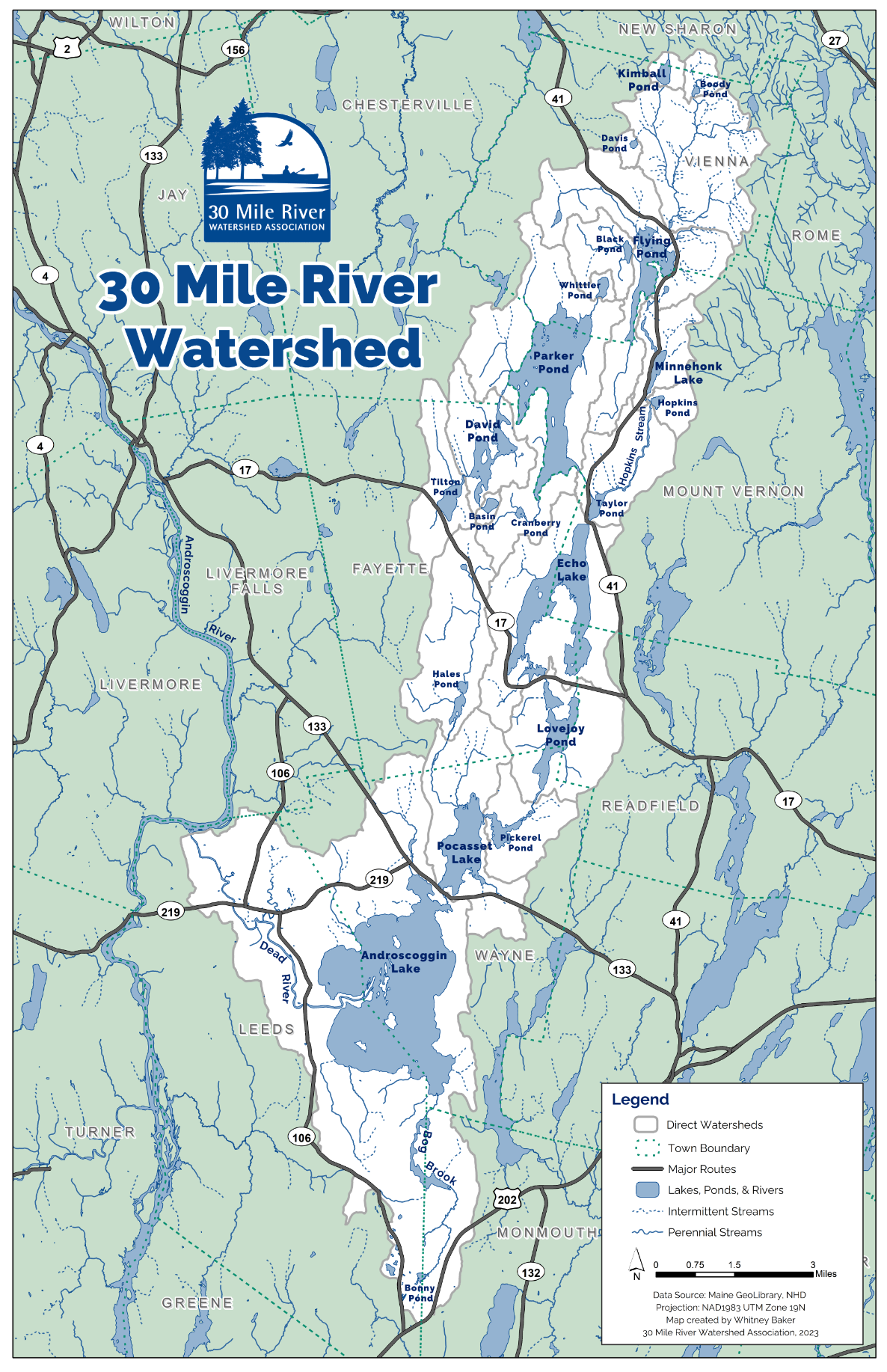
The 30 Mile River Watershed is all the area that drains through the Dead River into the Androscoggin River. This area includes everything within its boundaries: the land, water, plants, animals, buildings, farms, roads and people.
Everything that happens in a lake’s watershed eventually impacts the lake’s water quality, for better or worse.
towns
counties
watershed
Lakes, Ponds, and Streams
in the 30 Mile River Watershed
Androscoggin Lake
Basin Pond
Black Pond
Bonny Pond
Boody Pond
Cranberry Pond
David Pond
Davis Pond
Dead River
Echo Lake
Flying Pond
Hales Pond
Hopkins Pond
Hopkins Stream
Jennings Stream
Kimball Pond
Lovejoy Pond
Mill Ponds (4)
Minnehonk Lake
Parker Pond
Pickerel Pond
Pocasset Lake
Taylor Pond
Tilton Pond
Whittier Pond
Photo Credit: Karen Kurkjian (Banner)

