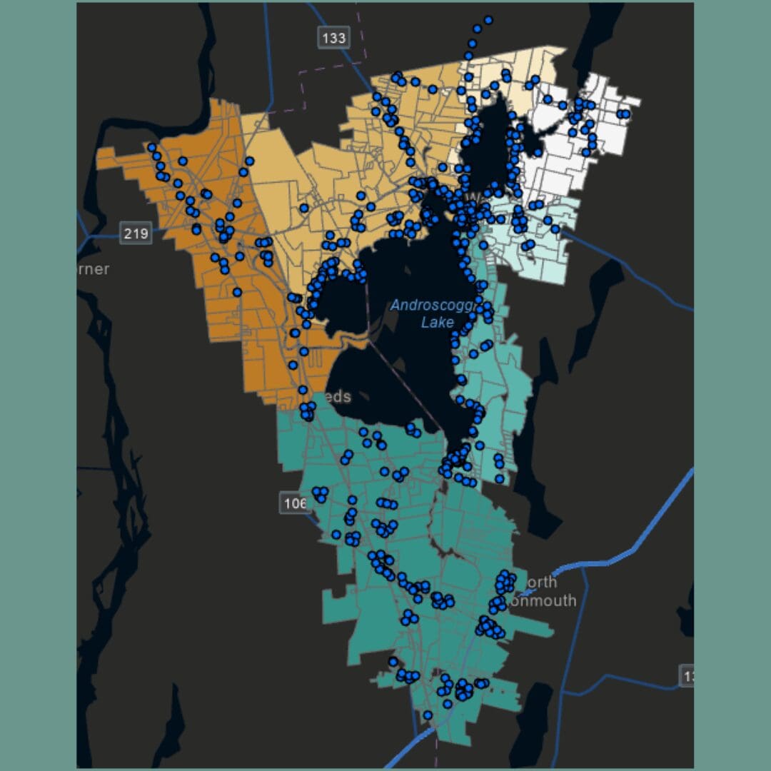
Chris Reed joined 30 Mile this summer as a GIS intern, in partnership with the Maine Geospatial Institute. The overarching goal of this internship was to analyze the distribution of septic systems across the Androscoggin Lake Watershed.
Chris successfully mapped the septic systems across the southern end of our watershed, pin-pointing each individual system. The original scope of the project focused solely on the Androscoggin Watershed, but as progress was made, we chose to include the Pocasset Lake and Pickerel Pond watersheds as well.
Each point mapped on ArcGIS Pro contains extensive information about the septic system, including: tax map/lot number, number of bedrooms in the residence, system design flow, system capacity, year installed, system type, disposal system components, and any additional notes for future work.
Looking ahead, the next steps for this project include running each point through an advanced plug-in to estimate potential nutrient loading into Androscoggin and the surrounding waterbodies via aging or poorly placed septic systems. This work builds upon our Septic System Vulnerability Study and we hope to have all of the data linked and available on our website in the coming months.
Chris will be volunteering his time with us throughout fall and winter to complete this project and assist in additional areas of interest. Thank you, Chris, for your work to protect our lakes, ponds, and streams!
This article was included in 30 Mile’s October 2026 newsletter. To view the full release, click here.